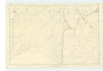
OS1/11/60/4
| List of names as written | Various modes of spelling | Authorities for spelling | Situation | Description remarks |
|---|---|---|---|---|
| BOWBEAT BURN | Bowbeat Burn Bowbeat Burn Bowbeat Burn Bowbeat Burn |
JS, Gilchrist William Penderleith Co..[County] Map Map of Roads |
022 | A small stream having its rise at the base of Bowbeat Hill and running northerly to its junction with Glad house Burn |
| BOWMANS GILL BURN | Bowmans Gill Burn Bowmans Gill Burn Bowmans Gill Burn Bowmans Gill Burn |
JS Gilchrist William Penderleith Co;[County] Map Map of Roads |
022 | A small stream havins its rise a little South of Jeffries Course, and running to Gladhouse Burn |
| FAIRHOPE BURN | Fairhope Burn Fairhope Burn Fairhope Burn Fairhope Burn |
JS, Gilchrist William Penderleith Co. [County] Map Road Map |
022 | A small Stream or burn running easterly to its junction with Gladhouse Burn, |
Continued entries/extra info
[page]4 Parish of Temple21-- Bowmans Gill Burn -- Rises about 1 3/4 Miles. W. [West] from [Trigonometrical point] on Black-hope Scar, and runs into Gladhouse water,
21 -- Fairhope Burn -- Rises about 1 7/8 Miles, W. [West] from [Trigonometrical point] on Blackhope Scar
22 -- Bowbeat Burn -- about 1 1/2 Mile. W. by S, [West by South] from [Trigonometrical point] on Blackhope Scar.
Transcriber's notes
a dot within a triangle I take to indicate a Trig. point.Unsure of Mr. Gilchrist's initials.
Transcribers who have contributed to this page.
ADobie
Location information for this page.


