OS1/11/60/5


| List of names as written | Various modes of spelling | Authorities for spelling | Situation | Description remarks |
|---|---|---|---|---|
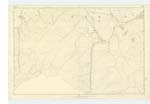
| BOWBEAT HILL | Bowbeat Hill Bowbeat Hill Bowbeat Hill Bowbeat Hill |
Mr.. Gilchrist Mr. Penderleith Map of Roads Co.. [County] Map |
022 | A considerable hill situated on the boundary line betwixt the County of Edinburgh and Peebles On it is a Trigl. [Trigonometrical] Station called by Trigl. [Trigonometrical] party " Browbeat Hill" |
| EMLY BANK | Emly Bank Emly Bank Emly Bank Emly Bank |
JS Gilchrist Mr. Penderleith Map of Roads Co.. [County] Map |
022 | An eminence of a ridge like shape, situated on the East side of Bowbeat Burn |
| GLADHOUSE WATER | Gladhouse Burn Gladhouse Burn Gladhouse Water Gladhouse Water Gladhouse Water |
Mr, Gilchrist Mr, Penderleith Co [County] Map Map of Roads |
022 | A considerable stream or burn having its name from the junction of Bowbeat Burn with other small tributaries, and running in a Northerly direction for a considerable distance then taking the name of South Esk. |
Continued entries/extra info
[page] 5 Parish of TempleEmly Bank -- about 1 1/4 Miles W.S.W. [West South West] from [Trigonometrical point] on Blackhope Scar.
Bowbeat Hill -- about 1 5/8 Miles W.S.W. [West South West] from [Trigonometrical point] on Blackhope Scar,
Gladhouse Burn -- about 1 1/8 of a mile from [Trigonometrical point] on Blackhope Scar
[Number in margin for all 3 entries] -- 22
Transcriber's notes
Unsure of Gilchrist's initials.A dot inside a triangle I take to mean a Trig. Point.
Transcribers who have contributed to this page.
ADobie
Location information for this page.