OS1/15/24/5


| List of names as written | Various modes of spelling | Authorities for spelling | Situation | Description remarks |
|---|---|---|---|---|
| THE BASS | Bass Rock Bass Rock Bass Rock Bass Bass The Bass The Bass The Bass The Bass The Bass |
George Adams John Kelly Andrew McLean Forrests Map of Hadd: [Haddingtonshire] Johnston's [Map of Haddingtonshire] Fullarton's Gazetteer New Statist: Acct: [Statistical Account] Sir Walter Scott's "Marmion" Old Statist: acct: [Statistical account] Chalmers Caledonia |
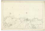
002 | [Situation] About 2½ Miles N.E. by E. [North East by East] An immense rugged perpendicular rock in the Firth of Forth, about 1½ miles northwards from the ruins of Tantallon Castle. It rises to the height of about 420 feet above the Surface of the sea, and from the depth of water around its total height may be estimated at about 600 feet. This rock is inaccesible on all sides excepting a flat shelvy point to the South east; the south and the north side of this point are the only two landing places. On this rock are the remains of a Chapel and a Castle; this Castle was the state prison of Scotland during the persecutions of Charles II [2]. The Bass is remarkable as being the last place in Great Britain which held out for the Stewart dynasty. Great quantities of sea fowl called the Solan Goose or Gannet breed on this rock; this, with Ailsa Craig are the only places in Scotland frequented by these fowl. |
Continued entries/extra info
[Page] 5Parish of North Berwick
Page In Forms 136
47 Bass Rock
Transcriber's notes
The description is continued on the next page.Transcribers who have contributed to this page.
DANIALSAN, Douglas Montgomery
Location information for this page.
Linked mapsheets.