OS1/35/87/4


| List of names as written | Various modes of spelling | Authorities for spelling | Situation | Description remarks |
|---|---|---|---|---|
| DUNMAN HEUGHS | Dunman Heughs Dunman Heughs |
John Brown Robert Bone |
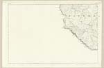
035 | [situation] On the coast adjoining Dunman (hill) NW [North West] side of Auchneight Moor A range of steep rocky precipices overhanging the sea & forming the West boundary of Duman from which they derive their names. |
| SLIDDERY STONE | Sliddery Stone Sliddery Stone |
Alexander Millagan Robert Bone |
035 | [situation] 32 Chains W [West] by N [North] of Auchneight (farm house) An oblong rock on the farm of Auchneight, sloping on both side from its summit, it is about 3yds [yards] above the level of the ground. |
| FORT (Site of) [Dunman] | Fort (Track of) Fort (Track of) |
William Todd John Brown |
035 | About ¾ mile west of Auchneight (farm house) A place of Strength on the Summit of Dumnan and is said to have been one of the Pictish strongholds, it is formed by the steep rocky precipice on the North & West sides and an artificial rampart (the top of which is yet Visible) on the East. |
Continued entries/extra info
[page] 4Parish of Kirkmaiden
Form 136
Page - 79 - Dunman Heughs
- 83 - Sliddery Stone
- 79 - Fort (Track of)
[note] "Dunman, a high rocky hill overhanging the sea,
"at the S.W. [South West] corner of the Parish, has on its summit the remains
"and distinct traces of a fortification" said to have been a place
"of strength in the days of the Picts." Statistical Acct. [Account] 1841 page 207
Transcribers who have contributed to this page.
Chr1smac -Moderator, Brenda Pollock
Location information for this page.