OS1/35/80/13


| List of names as written | Various modes of spelling | Authorities for spelling | Situation | Description remarks |
|---|---|---|---|---|
| CRUGGLETON | Cruggleton Cruggleton Cruggleton Cruggleton Cruggleton |
Andrew Broadfoot Alexander Montgomery Map of farm 1844 G.C. Dinwoodie Alexander MacCulloch |
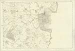
030 | [Situation] 1¼ miles S by E [South by East] of Galloway House. A farm house with Offices and a farm of land attached on the estate of Sir Andrew Agnew Bart. [Baronet] of Lochnaw. |
| COTE HILL | Cote Hill Cote Hill Cote Hill |
Andrew Broadfoot Alexander Montgomery Map of Farm 1844 |
030 | [Situation] 1½ miles S by E [South by East] by Galloway House A Small arable hill upon the farm of Cruggleton |
| CRUGGLETON POINT | Cruggleton Point Cruggleton Point Cruggleton Point Cruggleton Point |
Andrew Broadfoot Alexander Montgomery Peter Muir Statistical acct [account] 1841 |
030 | [Situation] 1½ miles SSE [South South East] Galloway House A Rocky headland projecting about 10 chains into Garliestown Bay it is a steep and irregular precipice about 240 feet high and on its Summit is the ruins of Cruggleton Castle it is upon the farm of Cruggleton and estate of Sir Andrew Agnew Bart. [Baronet] of Lochnaw. |
Continued entries/extra info
[Page] 13Parish of Sorbie
Form 136
Page 43- Cruggleton
43- Cote Hill
45- Cruggleton Point
Transcribers who have contributed to this page.
Chr1smac -Moderator, DANIALSAN
Location information for this page.
Linked mapsheets.