OS1/35/80/14


| List of names as written | Various modes of spelling | Authorities for spelling | Situation | Description remarks |
|---|---|---|---|---|
| CRUGGLETON CASTLE | Cruggleton Castle Cruggleton Castle Cruggleton Castle Cruggleton Castle Cruggleton Castle Crugleton Castle Crugleton Castle Cruggilton Castle Crugleton Castle Crugleton Castle Cruggleton Castle |
Andrew Broadfoot Peter Muir Alexander Montgomery Stat, acct [Statistical Account] of Wigtownshire page 29 Alexander MacCulloch Ainslies Map 1782 General Map of Scotland Rl. [Royal] Engineers Map 1819 Sinclair's St. [Statistical] account V1 [Volume 1] P. [Page] 264 Chalmers Caledonia Vol. 3 P 428 [Volume 3 Page 428] History of Galloway Vol [Volume] 2 P. [Page] 202 |
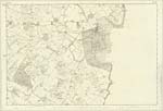
030 | [Situation] At the South Side of Cruggleton Point About 1½ miles SSE [South South East] of Galloway House. The Castle of Cruggleton which gave name to the parish in which it stood, was built on the verge of a precipitous part of the Sea Coast. nothing now remains of it save part of one arch and the foundations of some of the walls it is Situated on a Small promontory or headland between Rigg Bay & Port Allan & is about 200 feet perpendicular above the level of the Sea. Chalmers' Caledonia Vol. [Volume] III P. [Page] 372 informs us that Cruggleton Castle existed in the 13th. Century and was the property and residence of John Comyn Earl of Buchan the same Author further informs us that in 1292 John Comyn Earl of Buchan obtained from Edward I a licence to dig in the ruins of the Calf of man for lead to cover eight towers (See next Page] |
Continued entries/extra info
[Page] 14Parish of Sorbie
Form 136 Page
46 Cruggleton Castle (In Ruins)
Transcribers who have contributed to this page.
Chr1smac -Moderator, DANIALSAN
Location information for this page.
Linked mapsheets.