OS1/35/67/6


| List of names as written | Various modes of spelling | Authorities for spelling | Situation | Description remarks |
|---|---|---|---|---|
| MILLDRIGGAN | Milldriggan Milldriggan Milldriggan |
Mr. J. Broadfoot Mr. Collin Christison Ainslie's map 1782. |
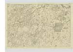
025 | [Situation] on the Main Road from Wigton to Kirkinner about 1/3 of a mile North of the latter place - A Small district comprising of farm house, Corn,& flour mill & a few scattered cottages - |
| KIRKLAND HILL | Kirkland Hill Kirkland Hill |
Mr. J. Christison Mr. J. Broadfoot |
025; 026 | [Situation] Immediately west of the Main Road between Milldrigggan and Kirkinner A high hill on the farm of West mains on its Summit is a Trig ◬ [Trigonometrical Station] called after this hill by the Trig [Trigonometrical] party - |
| BANK HILL | Bank Hill Bank Hill |
Mr. Robert McClelland Mr. C. Christison |
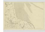
026 | [Situation] about 1/4 mile North of "Balfern " (North) 7/8 Mile East of Kirkinner A high hill on the farm of Balfern (North) on its Summit is a Trig ◬ [Trigonometrical] Station called Bank End by the Trig [Trigonometrical] Party at the N.W. [North West] part of the hill is found a precipice, caused by the beating of the Sea at some early period- |
Continued entries/extra info
[Page] 6 -- Plan 26 A -- Parish of KirkinnerForm 136
Page - 23 - Milldriggan
23 - Kirkland Hill
30 - Bank Hill
Transcribers who have contributed to this page.
Chr1smac -Moderator, joseph mc keown
Location information for this page.