OS1/35/40/12


| List of names as written | Various modes of spelling | Authorities for spelling | Situation | Description remarks |
|---|---|---|---|---|
| CAMRIE FELL | Camrie Fell Camrie Fell Camrie Fell |
William McMaster Robert Clanachan Gamekeeper George McHaffie Esqr. |
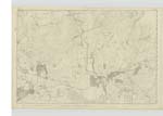
017 | [Situation] 2 miles N [North] of Glenluce & 1 mile East of Gabsnout Bridge. A small rough heathy hill Situated on Camrie farm on the [summit] of this hill is a Trigl. ◬ [Trigonometrical Station] |
| AIRYHEMMING | Airyhemming Airyhemming Airyhemman Airyhemming Airyhemming Airyhemming |
Thomas Williamson W.T. Saunders Ainslie's map 1782 James Gibson Esq. George McHaffie Esqr. Plan 17C |
017 | [Situation] In the N.W. [North West] of the Ph. [Parish] of Old Luce 5/8 mile South of Gabsnout Bridge. A farm house of good [construction] one story high in good repair with suitable office houses and a large farm attached chiefly moorland occupied by Thomas Williamson - The property of Sir James D Hay Bart. [Baronet] - on this farm is a Trigl. [Trigonometrical] station named after [the] farm - the small hill on which [it] stands is not Known by any particular name |
| AIRYHEMMING WOOD | Airyhemming Wood Airyhemming Wood |
Thomas Williamson WT Saunders |
017 | [Situation] East of Airyhemming Farm House. A small plantation of Ash & Fir Trees, on the farm of Airyhemming. |
Continued entries/extra info
[Page] 12Parish of Old Luce
Form 136 Page
17 - Camrie Fell
21 - Airyhemming
63 - Airyhemming Wood
Transcribers who have contributed to this page.
Chr1smac -Moderator, JCB
Location information for this page.
Linked mapsheets.