OS1/35/35/4


| List of names as written | Various modes of spelling | Authorities for spelling | Situation | Description remarks |
|---|---|---|---|---|
| SPRING BANK | Spring Bank Spring Bank Spring Bank Springbank |
Revd. [Reverend] D. Bennet John Adair Esqr. John McFadden Rl. Engrs [Royal Engineers] Map 1819 |
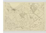
016 | [Situation] About one mile W. by N. [West by North] from the Ph. [Parish] Church of Stranraer A neat farm house and out offices in good repair with a farm attached of about 100 acres of arable land The property of R.V. Agnew Esqr. This place was formerly of the Lands of Gallow's Hill. |
| SPRING BANK PLANTATION | Spring Bank Plantation Spring Bank Plantation Spring Bank Plantation |
John Adair Esqr. John McFadden Rev. [Reverend] D. Bennet |
016 | [Situation] at the South side of SpringBanK A large Plantation chiefly of fir of about 30 years standing. The property and in the possession of R.V. Agnew Esqr. This place was also part of gallow's Hill. On the boundary of this plantation is a Trigl. [Trigonometrical] Station called by the Trigl. [Trigonometrical] Party "Gallow's Hill " |
| SHEUCHAN BRIDGE | Sheuchan Bridge Sheuchan Bridge |
Mr. Murray Road Surveyor George McHaffie Esqr. |
016 | [Situation] 13 Chains West of Sheuchan Mill A Small Stone Bridge of One Arch on the Road from Stranraer to Kirkcolm. It is a County Bridge- |
Continued entries/extra info
[Page] 4 -- Parish of LeswaltPage- 88, 221 -- Spring Bank
Page - 88, 89 -- Spring Bank Plantation
-- Sheuchan Bridge
Transcribers who have contributed to this page.
Chr1smac -Moderator
Location information for this page.
Linked mapsheets.