OS1/35/35/3


| List of names as written | Various modes of spelling | Authorities for spelling | Situation | Description remarks |
|---|---|---|---|---|
| GAYFIELD | Gayfield Gay -field |
John Adair Esq. John Crawford |
016 | [Situation] About 1 3/8 miles N.W. [North West] from the Parish Church Stranraer A Small Slated farm house & Some outhouses with a farm attached of About 30 acres of arable land occupied by George Neil. The property of R.V. Agnew Esqr. |
| HIGH SPIRRY | High Spirry High Spirry Spirrie Spirrie |
John Adair Esqr John McFadden Ainslie's map 1782 Rl. Engrs. [Royal Engineers] Map 1819 |
016 | [situation] 1 3/8 mile W.N. W. [West North West] from the Parish ch. [church] Stranraer A good farm house well constructed one Story high with outhouses all in good repair and a farm of about 30 acres of arable land attached occupied by David Aiken. The property of R.V. Agnew Esqr. |
| HIGH LARG | High Larg High Larg Larg |
John Adair Esqr John McFadden Ainslie's Map 1782 | 016 | [situation] About mile W.N. W. [West North West] from the Parish ch. [church] Stranraer A Small thatched farm house with outhouses and about 8 acres of land attached. the property of R.V. Agnew Esqr. |
Continued entries/extra info
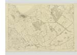
[Plan] 16 A - -- Parish of Leswalt -- [Page] 3page - 85 Gayfield
86 High Spirrry
87 High Larg
Transcribers who have contributed to this page.
Chr1smac -Moderator
Location information for this page.
Linked mapsheets.