OS1/35/25/4


| List of names as written | Various modes of spelling | Authorities for spelling | Situation | Description remarks |
|---|---|---|---|---|
| BLACK BURN | Black Burn Black Burn Black Burn |
Mr. James Stroyan Mr. John McIlwrick George McHaffie Esqr. |
012 | [Situation] West of Parish and 1½ Miles East of Tarf Water This Burn rises in the bog of Kilhockadale and contributes to the river Bladenoch |
| LOW AIRIES | Arries Arries Airies Low Aires Low Airries Low Airies |
John Harg James Campbell Mr Alexander Hunter (Farmer) Ainslie's Map 1782 List of Properties George McHaffie Esqr, |
012 | [Situation] 5½ Miles N.W. by W. [North West by West] of Kirkcowan Village and ¾ Mile East of Tarf Water. A good farm house with out houses and a farm attached. It is the property of the Marquis of Bute. |
| DRUMALLOCH | Drumalloch Drumalloch Drumalloch Drumulloch Drumalloch |
Robert Hannah James Cambell Mr. Alexander Hunter Farmer List of Properties Ainslie's Map 1782 George McHaffie Esqr. |
012 | [Situation] 5 Miles N.W. [North West] of Kirkcowan Village and 1¾ Miles East of Tarf Water. A House and farm attached to Belminoch. |
Continued entries/extra info
[Page] 4Parish of Kirkcowan
Blackburn - Form 136 - Page 27
Arries - Form 136- Page 27
Drumalloch - Form 136 - Page 28
"Airdh" - A Shealing; hill pasture or summer residence for herdsmen & Cattle Gaelic Dictionary.
"Druim" - A Knoll, a ridge etc - Gaelic Dictionary.
Transcribers who have contributed to this page.
Chr1smac -Moderator, DANIALSAN
Location information for this page.
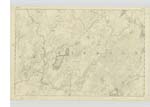
Linked mapsheets.