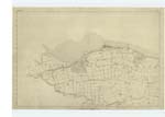
OS1/34/69/1
| List of names as written | Various modes of spelling | Authorities for spelling | Situation | Description remarks |
|---|---|---|---|---|
| Site of GRIME'S DYKE or ANTONINUS'S WALL | Wall of Antoninus Pius Roman Wall - Called Grime's Dyke. Grime's Dyke or Wall of Antoninus Pius |
Stewart's Caledonia Romana Genl General Roy's map of the Wall Chalmers Caledonia |
001 | The site of the Roman Wall and Road which is now shewn on this Plan. I have insered in accordance with the opinion of the most intelligent in the locality, and also in accordance with the written accounts and maps which have been published hitherto concerning this work particularly those of General Roy and Mr. Stuart, Author of the Caledonia Romana. Although there are but very little Remains existing of the Wall at present, yet from the nature of the ground and the scanty Remains discovered, there is little doubt but that the line now shewn on Plan will differ (if at all) only in very few places from the original. Commencing my enquiry and research at Inveravon, I consulted Mr. Walker the occupier of the Farm at this place, and he states that his Uncle, Mr. Thompson (who was his predecessor in this Farm) dug up a considerable portion of the Roman Road, which had been previously used by him as a Cart Road, the Paving Stones of the Road were removed about 18 years ago; this portion of the Causeway extended from the letter A on plan westward to the Old Tower;- Mr. Thompson was of opinion that at this place, one of the Forts or Stations on the Wall must have stood, and that the Site of the Wall is identical with the present public road from a to b., and from a it ran a little north of the road, and nearly parallel to it, and directly North of the Old Tower, thence taking a South-west direction, as shewn on Plan across the River Avon. It is evident as General Roy remarks that the River has made some encroachments here on its eastern bank, as there is not at present sufficient space for the Site of the Fort so as to place it on the South side of the Wall, where it is probable it may have stood. It is the opinion of Mr. Walker and also the opinion of all the [page torn] consulted that the Old Tower stands within the Site of the Fort, and from the appearance of the ground and from the [page torn] |
Continued entries/extra info
[Page] 1Sheet No.1 - six Inch Scale Co. [County] Linlithgow
[Date Stamp] ORDNANCE SURVEY M.S. STORE 22 MAY. 95 SOUTHAMPTON
[note in left margin] Note The Wall was evidently built in the year 140 or Commenced there and finished about 144
[note on page] As the precise Sites of the Forts or Military Stations also the Wall within this plan were not well ascertained, Supposed Site of Fort is therefore recommended to be written to each on plan.
Transcriber's notes
the bottom right hand corner of the page is torn with some of the words missing in the "description remarks" section.Transcribers who have contributed to this page.
Bizzy- Moderator, alamer
Location information for this page.
Linked mapsheets.


