OS1/34/69/2


| List of names as written | Various modes of spelling | Authorities for spelling | Situation | Description remarks |
|---|---|---|---|---|
| Site of GRIME'S DYKE or ANTONINUS'S WALL | Wall of Antoninus Pius Roman Wall - Called Grime's Dyke. Grime's Dyke or Wall of Antoninus Pius |
Stewart's Caledonia Romana Genl General Roy's map of the Wall Chalmers Caledonia |
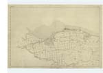
001 | of the Road going directly into the Tower, the Wall must have been immediately North of it. But as there have been no Remains found, nor any appearance to indicate where the Wall crossed the Avon, judging from the appearance of the ground and the shallowness of the River, it is generally believed to have crossed at a point which is fordable, as now shewn on Plan. Proceeding Eastward, some large Stones were dug up when the Slamannan and Borrowstouness Railway was being constructed; Mr. Alexander Kirkwood of the Farm of Hainnings states that he saw these large stones dug out of the Railway cutting, where the Site of the Wall is now shewn crossing it. Continuing still Eastward towards Kinniel:- from c to d, a portion of the Roman Road was dug up here, about 40 years since, by the Farmer of Nether Kinniel Mr Robert Learmonth, and he states that, immediately facing his Farm House, several yards of the Pavement still remains untouched, about 18 inches beneath the surface of the field, and is quite perfect, between 15 and 20 feet wide, he describes it as being constructed with large and small stones (whinstone and freestone), with well defined edges, composed of curb-stones, nearly of equal size.- Some Remains of the Wall are pointed out a little South of Kinneil House, where it crossed a Burn, these Remains consist of some slight traces of mason work, conjectured to be the remains of the bridge over which the Wall crossed the Burn. Proceeding thence to Dean, at c, whilst the gardener William Luck was constructing a Park at this spot about 2 years ago, having occasion to make some excavation; about 3 feet beneath the surface, he came upon what seemed to be a rudely constructed Wall, consisting of very large stones and earth, and having excavated to the depth of 12 feet, he did not come to the foundation, several gentlemen who came to see it from Edinburgh, Glasgow. Falkirk, and other places, were all of opinion that it was the Remains of the Rampart. About the same time that the above Remains were discovered the gardener had also occasion (in constructing a Bowling Green) to clear away the surface, a little South of the house of Dean, where he discovered a considerable extent of Pavement, made mostly with small stones ,(having a mixture of sand and gravel worked among them) the surface of which appeared to have been much worn away, [page torn] for a Roadway; but surpassing in width the ordinary breadth of the Roman Causeway; being about 40 feet [page torn] ; and this, being about the distance on the Wall from Inveravon, where another Fort might be expected to have |
Continued entries/extra info
[Page] 2[continued from previous page]
Transcriber's notes
he bottom left hand corner of the page is torn with some of the words missing in the "description remarks" section.Transcribers who have contributed to this page.
Bizzy- Moderator, alamer
Location information for this page.
Linked mapsheets.