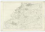
OS1/34/46/11
| List of names as written | Various modes of spelling | Authorities for spelling | Situation | Description remarks |
|---|---|---|---|---|
| LONGMUIR PLANTATION | Longmuir Plantation Longmuir Plantation Lang Moor Plantation |
Mr. Ruthven Beecraigs Mr. John Robertson Ochiltree Mill Forrest's Co. [County] map |
005 | [situation] At the eastern side of Riccarton Hills. A very large tract of ground, enclosed, and planted with mixed wood; a wide road runs through the southern part of it, made expressly for the accommodation of gentlemen when hunting; it is the property of the Earl of Roseberry. |
| BROOMY KNOWES | Broomy Knowes Broomy Knowes Broomyknows |
Mr. P. Wilson Broomy Knowes Mr. James Ruthven Beecraigs Forrest's Co. [County] map |
005 | [situation] NE [North East] part of Riccarton Hills Three or four middling sized hills, comprising part of the Riccarton Hills, the surface being rough pasture and furze; on the highest Knowe there is an excellent view to be had of the surrounding district; and on it there is a Trignometrical Station called Broomy Knowe, the property of the Earl of Selkirk. |
Continued entries/extra info
[page] 11Parish of Linlithgow -- Sheet 5 No. 12 -- Trace 3
Transcribers who have contributed to this page.
Moira L- Moderator, Ray Kidd
Location information for this page.
Linked mapsheets.


