OS1/30/3/13


| List of names as written | Various modes of spelling | Authorities for spelling | Situation | Description remarks |
|---|---|---|---|---|
| Loch of the Lowes | Loch of the Lowes Loch of the Lowes Loch of the Lowes |
Mr John Laidlaw Chapelhope Mr Walter Anderson Summerhope Mr William Graham Riskinhope |
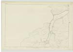
013 | A lake about three quarters of a mile in length and nearly a quarter of a mile in breadth, situated between two hills known as the Long Bank, and Riskinhope Rig; it is divided from St Mary's Loch by a narrow neck of land , along which runs the county road from Selkirk to Peebles and Moffat. |
| Quave Brae | Quave Brae Quave Brae Quave Brae Quave Brae |
John Laidlaw Walter Andeson William Graham The Ettrick Shepherd Walter Copeland Esq Thirlestane |
013 | A hill covered with rough and heathy pasture, and situated about half-a-mile from the farm house of Chapelhope and between the Chapelhope burn and Yarrow Water. |
| Shielhope Hill | Shielhope Hill Shielhope Hill Shielhope Hill |
John Laidlaw Walter Anderson William Graham |
013 | A high hill in the farm of Shielfield over which the county boundary crosses, is about a mile west of Ratlin Side. |
| Ratlin Side | Ratlin Side Ratlin Side Ratlin Side |
John Laidlaw Walter Anderson William Graham |
013 | A hill about half a mile north of the head of Chapelhope burn. |
Continued entries/extra info
Parish of Ettrick 13Sheet 13 Six Inch Trace 4 & 5
Described by Sapper Montgomery R E [Royal Engineers]
Transcribers who have contributed to this page.
Skinnb1- Moderator
Location information for this page.
Linked mapsheets.