OS1/27/4/64


| List of names as written | Various modes of spelling | Authorities for spelling | Situation | Description remarks |
|---|---|---|---|---|
| GÈILLTEAN | Gèolltean | Donald Murray Cushader Informant could not spell John Morrison Ordce [Ordnance] Survey |
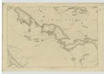
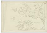
003 | Those are a large quantity of High and low water Rock the greater number is Isolated Some of them are about 40 feet high having no vegetation but Comprised of Shelving rock they extend along and adjacent to the coast line from Rudha na Cloiche Baine to Long Dhomhnuill Mhic Uillaim a distance of about 40 chains the Sea is quite shallow from there to Braga Rock. |
| RUDHA NA CLOICHE BAINE | Rudha na Cloiche Baine | Donald Murray Cushader Informant could not spell John Morrison Ordce [Ordnance] Survey |
003 | This is a Small Sharp rather high point of Shore commanded by a Small but Steep Rocky cliff about 50 feet high Situated about 1/2 mile South east of Sgiogartaigh village. |
| CAITHASEADAIR | Caithaseadair | Donald Murray Cushader Informant could not spell John Morrison Ordce [Ordnance] Survey |
003 | Those are the Ruins of a few old houses occupied about 50 years ago by one Family they Scarcely can be Seen there is a Small portion of green or arable land around them Situated adjacent to and west of Rudha Geal. |
Continued entries/extra info
[page] 64Plan 3 D -- List of Names collected by Thomas O Farrell C A [Civilian Assistant]
Trace 3
Township or Parish - Barvas
Object
Gèolltean - Rocks
Rudha na Cloiche Baine - Point of Shore
Caithaseadair - Ruins
[signed] Thomas O Farrell ca [civilian assistant]
8th May 1852
Transcribers who have contributed to this page.
Bizzy- Moderator, eilthireach
Location information for this page.