OS1/27/4/63


| List of names as written | Various modes of spelling | Authorities for spelling | Situation | Description remarks |
|---|---|---|---|---|
| DRUIM CHAITHASEADAIR | Druim Chaithaseadair | Donald Murray Cuishader Informant could not spell John Morrison Ordce [Ordnance] Survey |
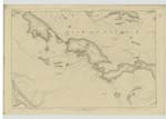
003 | This is a low long Mossy and RocKy pasture hill extending from north to South about 50 chains and about 80 feet high Situated north West of Rudha Geal there is a Trig [Trigonometrical] Station on its top. |
| ALLT FADA | Àllt Fada | Donald Murray Cushader Informant could not spell John Morrison Ordce [Ordnance] Survey |
003 | This is a small stream which flows from between Campar Mor and Druim Bhata Guaille in a northerly direction till it joins Amhuinn Sgiogarstaigh. |
| ÀLLT SHEILASTOTAIR | Àllt Sheilastotair | Donald Murray Cuishader Informant could not spell John Morrison Ordce [Ordnance] Survey |
003 | This is a Small but rapid [stream] which flows from the South base of Druim Bhata Guaille in a northerly direction by Bhata Guaille and Seilastotair till it meets Allt Fada from which Junction it is called Amhuinn Sgiogartaigh till it falls into the Sea. |
Continued entries/extra info
[page] 63Plan 3 D -- List of Names collected by Thomas O Farrell C A [Civilian Assistant]
Trace 3
Township or Parish - Barvas
Object
Druim Chaithaseadair - Hill
Àllt Fada - Stream
Àllt Sheilastotair - Stream
Thomas O' Farrell ca [civilian assistant]
8th May 1852
Transcribers who have contributed to this page.
Bizzy- Moderator, eilthireach
Location information for this page.