OS1/25/31/3


| List of names as written | Various modes of spelling | Authorities for spelling | Situation | Description remarks |
|---|---|---|---|---|
| FORTEVIOT (Detached No 1) | Part of Forteviot Ph [Parish] Part of Forteviot Ph [Parish] Part of Forteviot Ph [Parish] Part of Forteviot Ph [Parish] and MucKersie |
Stobies Co. [County] map Johnston's Co. [County] map New Stat. Acct. [Statistical Account] Fullarton's Gazetteer |
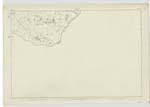
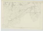
119 ; 120 | [Situation] In the South-eastern portion of Perthshire This is a detached portion of the parish of Forteviot, its shape or figure approaching to somewhat of an oval form or of an ellipsoidal form of about 2 miles by 1⅓ and is bounded on the N W. [North West] and N. [North] by Forgandenny, and on all other sides by Kinross-shire. The May Water traces its boundary ¾ of a mile on the N W [North West] and a rilly tributary of that stream 1¼ mile on the north. The district lies wholly among the Ochil hills and possesses in general their distinctive features.- see Descriptive Rks. [Remarks] of Forteviot Parish. |
Continued entries/extra info
[Page] 3[Note] The parish consists of the Main body- & 1 Detached portion - on 86 & 98 1 Detached portion - discribed above - on 119 - 120 all in Perthshire O.M.O. [Ordnance Map Office]
Transcribers who have contributed to this page.
Bizzy- Moderator, KBMW- Moderator
Location information for this page.