OS1/25/29/33


| List of names as written | Various modes of spelling | Authorities for spelling | Situation | Description remarks |
|---|---|---|---|---|
| CASTLE LAW | Castle Law Castle Law Castle Law Castlehill ruins of a Pictish Fort Castle-Law Castle-law |
David McCulloch Shepherd William Murray Pitcaithkly Mains David Halley Lochend Stobie's Co. [County] map - 1805 New Stat. Acct. [Statistical Account] Old Stat. Acct.[Statistical Account] |
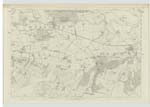
109 | [Situation] On the eastern boundary of the parish A hill of Considerable elevation Situate on the farm of Westhall at the East end of Cultucher Hill On the top of this hill is a large encampment which seems to have been at one time of Considerable importance On the south (being its easiest assailed side, it was defended by three deep ditches. the other sides did not require such defences as the hill at those parts is very steep, This encampment is not known by any name save Castle Law |
| FORT (Remains of) [Castle Law] | Castle Law Castle Law Castle Law Castlehill ruins of a Pictish Fort Castle-Law Castle-law |
David McCulloch Shepherd William Murray Pitcaithkly Mains David Halley Lochend Stobie's Co. [County] map - 1805 New Stat. Acct. [Statistical Account] Old Stat. Acct.[Statistical Account] |
109 | [Situation] On the eastern boundary of the parish A hill of Considerable elevation Situate on the farm of Westhall at the East end of Cultucher Hill On the top of this hill is a large encampment which seems to have been at one time of Considerable importance On the south (being its easiest assailed side, it was defended by three deep ditches. the other sides did not require such defences as the hill at those parts is very steep, This encampment is not known by any name save Castle Law |
Continued entries/extra info
[Page] 33Parish of Forgandenny -- Sheet 109 No 12 Trace 3
Note. As Castle Law is evidently a hill name let Castle Law be written so as to apply to the hill and Fort (Remains of) to the Fort.
Somewhat more than a mile South from Forgan is a place called
Castle-law. It is situated upon the Summit of a very high hill which
resembles a low cone. The Circumference of its area is about 500 yards. This
spot is defended on all sides by a Stone wall the vestiges of which are
yet to be Seen; these vestiges are of a form nearly circular and the walls
seem to have taKen their form from the top of the hill on which they are
built. Besides this wall there are also Several outworKs which
seem to have been formed for defence; particularly on the South
where the hill is less steep and the ground below higher, there are
three mounds of earth parallel to the wall and to each other. Within the area of this castle or fortification
are the vestiges of buildings; and there was erected by the former Lord Ruthven on this spot a sort of half tower
which is yet standing. This place commands a prospect of the Country to the mouth of the Tay or the German
Ocean on the east all Strathearn to the Grampian mountains
on the west a great part of Perthshire and Angushire on the north and North-east and the top of the
Lomond Hills on the South. The general opinion concerning Castle-law is that it had been a Danish fortification
Old Stat. Acct. [Statistical Account] vol. [volume] 3 p. [page] 309
Transcribers who have contributed to this page.
Bizzy- Moderator, Douglas Montgomery
Location information for this page.
Linked mapsheets.