OS1/24/40/28


| List of names as written | Various modes of spelling | Authorities for spelling | Situation | Description remarks |
|---|---|---|---|---|
| GLENGABER BURN | Glengaber Fingland Burn Glengaber Burn Glengaber or Fingland Burn |
[Revd. [Reverend] Reverend James Campbell Statist [Statistical] Acct. [Account] 1794 New Statist [Statistical] Acct. [Account] |
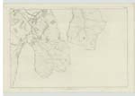
018 | [Situation] Has its source in Yarrow Parish above Glengaber & Hennel and discharges itself into the Quair at Traquair Mill. A considerable tributary of the Quair and constitutes the boundary between the farms of Traquair Knowe and Damhead. - |
| NEWHALL BURN | Newhall Burn Newhall Burn Newhall Burn |
[Revd] [Reverend] James Campbell Thomson's Atlas (Peebles) Pennecuiks description |
018 | [Situation] Separating the Parishes of Traquair and Yarrow about 200 Yards east of Traquair Church. This Burn (which derives its name from a farm on its right bank) springs from the northern slope of the hills separating the valleys of the Tweed & Yarrow, and Constitutes the Boundary between the parishes of Yarrow & Traquair almost from the source of the main feeder to where it receives Shillinglaw or Curley Burn near Traquair Church, & about ¼ Mile above their united flow into the Quair. - Dr Pennicuik in one place calls it Kirkhouse Burn, from Kirkhouse situate on its left bank near its confluence with Quair. |
Continued entries/extra info
[Page] 28Traquair Parish
Sheet 18-5
Transcribers who have contributed to this page.
DANIALSAN, JOANMUIR
Location information for this page.
Linked mapsheets.