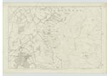
OS1/24/23/22
| List of names as written | Various modes of spelling | Authorities for spelling | Situation | Description remarks |
|---|---|---|---|---|
| INGRASTON MOSS | Ingraston Moss Ingraston Moss Ingraston Moss Ingraston Moss |
John White Felton James Crichton Medwyn Mains James Alston Hindfordwells Simon Ritchie Blyth |
008 | [Situation] In the South side of the parish of Linton and about 7/8 mile SW. [South West] of Medwin Mains An Extensive tract of Moss between the Tarth Water & the Turnpike Road. It was formerly more Extensive but has been partly reclaimed a [and] now under Cultivation, on the West & North of the present Moss. W.A. Woodrope Esq. of Garvald House is Proprie [Proprietor] |
| TARTH WATER | Tarth Water Tarth Water Tarth Water Tarth Water Tarth Water |
John White James Alston Simon Ritchie William Milne Scotstonrig Armstrong's Co. [County] map |
008 | [Situation] In the South end of the ph [parish] of Linton This River is formed by t [the] Black Burn Increased by Se [Several] Small Streams and the Surface and drain Water from Ingr [Ingraston] Moss. It commences at the S.Ea [South East] Corner of Ingraston Moss & flows in a S.W. [South West] direction, forming the Boundy [Boundary] between Peebles & Lan [Lanark] to Waterside; thence to Blyth Bridge the By. [Boundary] of the Parishes of Kirkurd & W. [West] Linton; it thence flows south [southwards] to its Junction with the Lyne Water. |
Continued entries/extra info
[page] 22Parish of Linton -- Sheet 8 No 1 -- Trace 4
Transcriber's notes
Words lost in fold of page.Transcribers who have contributed to this page.
Moira L- Moderator, JOANMUIR
Location information for this page.
Linked mapsheets.


