OS1/24/16/21


| List of names as written | Various modes of spelling | Authorities for spelling | Situation | Description remarks |
|---|---|---|---|---|
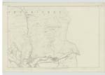
| LEE BANK | Lee Bank | James Nicol Shepherd William Tait Farmer |
014 | [Situation] About ½ Mile N.E. from the Rake. A large heathy hill on the farm of Lee - partly cultivated - and having a Trigonometrical Station on it. |
| COMMON KNOWE | Common Knowe | James Nicol Shepherd James Anderson Shepherd |
014 | [Situation] About ¾ of a Mile S.E. [South East] from Lee Bank. A small ridge on the farm of Common lying betwixt Harpershiels and Middle Burn. It bears evidence of having been once cultivated - and the ruins of the former dwelling house and garden, belonging to the said farms, are still to be found on it - near which ruin is a Trigonometrical Station. |
Continued entries/extra info
[Page] 21Parish of Inverleithen -- Sheet 14. No 5 Traces 3 & 6
[Entry for Harpershiels Burn scored out:]
See adjoining Trace
[Entry is on page 28]
Transcribers who have contributed to this page.
Alison James- Moderator, P Wills
Location information for this page.
Linked mapsheets.