OS1/24/16/19


| List of names as written | Various modes of spelling | Authorities for spelling | Situation | Description remarks |
|---|---|---|---|---|
| MOUSEDEAN BURN | Mousedean Burn Mousedean Burn |
William Tait Farmer James Andrew Shepherd |
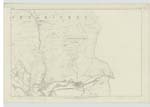
014 | [Situation] About ¼ of a Mile South from Lee Bank. A small stream rising at the foot of Mousedean head - runs betwixt the Rake and Lee Bank - and after joining with Lee burn, falls into the Leithen Water. |
| LEE BURN HEAD | Leeburn Head | William Tait Farmer | 014 | [Situation] About 1 Mile S.W. [South West] from Lee Bank. A portion of high land, covered with heathy pasture, at the head of Lee burn. On its highest point there is a Trigl. [Trigonometrical] station called Telpen No.2. On the farms of Lee and Nether Horsburgh. |
Continued entries/extra info
[Page] 19Parish of Inverleithen -- Sheet 14 No 5. Traces 6. 2.
[Start of an entry for Middle Burn has been crossed out.]
Transcribers who have contributed to this page.
Alison James- Moderator, P Wills
Location information for this page.
Linked mapsheets.