OS1/24/2/34


| List of names as written | Various modes of spelling | Authorities for spelling | Situation | Description remarks |
|---|---|---|---|---|
| BROOMYSIDE | Broomyside Broomyside Broomyside |
Robert Ritchie Cloverhill John Graham shepherd George Sandilands shepherd |
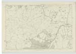
012 | [Situation] About ½ mile N.W. [North West] from Hammer Head A Hill or rather the sloping side of a steep Ridge forming a part of the range of Hills Called Broughton Heights. It is Situated on the Farms of Stirkfield & Stobohope Head; The Waterline over it forms the Boundary between the Parishes of Stobo & Broughton |
| COWIEMUIR HASS | Cowiemuir Hass Cowiemuir Hass Cowiemuir Hass |
Robert Ritchie John Graham George Sandilands |
012 | [Situation] About ½ Mile N.W. [North West] from Hammer Head This name applies to a "Hass" or neck of land Connecting Broomyside and Clover Law, and forming a Kind of Pass through the Range Called Broughton Heights where an old Bridle Road passes. It is named from a district which was called Cowiemuir but which has for many years formed a part of the Farm of Stirkfield. |
Continued entries/extra info
[page] 34Parish of Broughton
Sheet 12 No. 9 -- Trace 1
[Note] -- "Hass", -- A defile, a narrow Passage. -- Jamieson's Scott. Dicty [Scottish Dictionary]
Transcribers who have contributed to this page.
Moira L- Moderator, P Wills
Location information for this page.
Linked mapsheets.