OS1/11/31/15


| List of names as written | Various modes of spelling | Authorities for spelling | Situation | Description remarks |
|---|---|---|---|---|
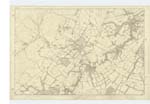
| ALLERMUIR HILL | Allermoor Hill Allermoor Hill Allermuir Hill Allermuir Hill Allermuir Hill |
James Steedman Revd. [Reverend] A. Torrence County Map Mr. Ramsay, Edinburgh Water Company's Map |
012 | About 1 mile west from Hillend Hill. A large hill, part of the farms of Boghall and Swanton. It is a part of the Pentland range. |
| KIRKYETTON HILL | Kirkyetton Hill Kirkyetton Hill Kirk Yetton Hill |
James Steedman R. Duncan County Map |
012 | About ¾ of a mile north-west from Boghall. A large hill part of the farms of Boghall and Swanston. It is part of the Pentland range. On its summit ia a Trig. [Trigonometrical] Station called "--". |
| WINDY DOOR NICK | Windy Door Nick Windy Door Nick |
J. Steedman Revd. [Reverend] A. Torrence |
012 | About ¼ mile east from Allermuir Hill. A hollow between Allermoor Hill and Kirk Yetton Hill. On the farm of Boghall. |
Transcriber's notes
Kirkyetton Hill Trig. Station name in fold of page.Transcribers who have contributed to this page.
Brenda Pollock
Location information for this page.
Linked mapsheets.