OS1/11/25/10


| List of names as written | Various modes of spelling | Authorities for spelling | Situation | Description remarks |
|---|---|---|---|---|
| CASTLE GREG | Camilty Hill Camilty Hill Castle Greg Castle Greg |
John Kerr John Watson Stat. Acct. [statistical Account] 1845 See Plan 16.B. |
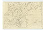
010 | [Situation] About 2 1/2 miles W.S.W. [West South West] from Cairns Castle Inn. A large arable eminence on the farm of "Camilty" on its summit is a Trig. [Trigonometrical] station. |
| CROSSWOOD BURN | Crosswood Burn Crosswood Burn Crosswood Burn |
John Kerr John Watson County map |
010 | [Situation] Runng [Running] N. [North] on the E [east] side of Camilty Moss. A small stream having its source on the farm of Middle Crosswoo [Crosswood] flowing in a northerly direction past Camilty farm house from whence it is called "Linhouse Water" See Rae Burn Page 20 - It is understood from this description and also the Descriptive remarks on Linhouse Water, page 15 that the junction of the names is at Camilty Bridge - the names are arranged accordingly on the plan - See remark No. 1 on plan - [Initialled] AMO 5th October 1852. |
| KELLY SYKE | Kelly Syke Kelly Syke |
William Kerr John Watson |
010 | [Situation] About 1 1/2 Miles S.W. by W. [South West by West] from Cairns Castle Inn. A small stream having its source on the farm of Wes [West] Colzium flowing in a northe [northerly] direction and falling into "Whitelea Burn" |
Continued entries/extra info
[Page] 10Parish of Midcalder
Transcriber's notes
That portion of Description of Crosswood Burn beginning with the words "See Rae Burn" is written in a different hand. A further entry in pencil has been written over, or more likely under, this portion but is not decipherable.Transcribers who have contributed to this page.
JCB
Location information for this page.
Linked mapsheets.