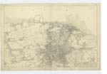
OS1/11/4/26
| List of names as written | Various modes of spelling | Authorities for spelling | Situation | Description remarks |
|---|---|---|---|---|
| GRANTON POINT | Granton Point | W. Colvin, Cramond Ma [Manse] Rev [Reverend] W Scrimgower, Caroline P [Park] |
002 | A promontory or headland running into the sea 1 1/2 miles west of Granton Pier, it abounds with bold rocks which are visible at Low Water, and which often prove dangerous to coasting vessels, it is considered the most Northernmost Point of Edinburghshire |
| GRANTON QUARRY (Sandstone) | Granton Quarry (freestone) | W. Colvin, Cramond Ma [Manse] Rev [Reverend] W Scrimgower, Caroline P [Park] |
002 | An extensive freestone Quarry situated at Granton Point the property of the Duke of Buccleuch: it presents an extensive area of excavated stone to the dept [depth] of 100 ft. [feet] and which is of an excellent quality, but owing to the considerable height of the sea above it renders the seaward part useless and the constant application of a Steam Engine to work of [off] the water. |
Continued entries/extra info
[Page] 26P. [Plan] 2. 4.
List of Names collected by John C Darnan RS [Royal Sappers] & Miners Examiner
Trace 1
[Parish] Cramond
[Object for Granton Point] Headland.
[Object for Granton Quarry] Quarry.
[Signed] John C Darnan Jany [January] 20th 18 [--]
Transcribers who have contributed to this page.
JCB
Location information for this page.


