OS1/20/93/4


| List of names as written | Various modes of spelling | Authorities for spelling | Situation | Description remarks |
|---|---|---|---|---|
| CRAIGBILL | Craigbill Craigbill Craigbill |
Robert Howitt Esqr James Smith Ainslies Map 1820 |
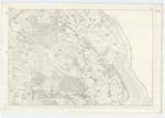
034 | [Situation] 1 1/8 miles N.E. by E. [North East by East] of Troston farm house. A small farm house and out houses (including a thrashiing machine} in good repair, with a small farm of land attached. Occupied by John Brown. The property of Robert Howitt Esqr. of Mabie. |
| LOW AUCHENFAD | Low Auchenfad (part in ruins) Low Auchenfad (part in ruins) Mickle Auchenfad |
Robert Howitt Esqr. James Smith Ainslies map 1820 |
034 | [Situation] 1 1/2 miles E.N.E. [East North East] of Troston farm house A farm house and out houses all in ruins with the exception of a part of the dwelling house which is presently occupied by a labourer, the land that was attached to this house is now let with the farm of Mid Auchenfad. |
| AUCHENFAD HILL | Auchenfad Hill Auchenfad Hill |
Robert Howitt Esqr. James Smith |
034 | [Situation] About 1 5/8 miles N.E. by E. [North East by East] of Troston farm house. A small hill on the farm of Low Auchenfad, its surface consists of rocky heathy pasture. On it is a Trigl. [Trigonometrical] Station called by Trigl. [Trigonometrical] Party "Auchenfad" |
Continued entries/extra info
[Page] 4Parish of Troqueer
Transcribers who have contributed to this page.
Brenda Pollock
Location information for this page.
Linked mapsheets.