OS1/20/101/8


| List of names as written | Various modes of spelling | Authorities for spelling | Situation | Description remarks |
|---|---|---|---|---|
| CARDOON BURN | Cardoon Burn Cardoon Burn Lane of Cardoon Lane of Cardoon Cardoon Burn |
John Burnie John Garroch Ainslies Map Map of County Plan 36 B |
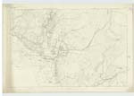
036 | [Situation] Running in a N. E [North East] direction from the S. [South] side of Door of Cairnsmore. A Small Stream or burn taKing its Rise on the farm of Culcronchie and running in an Easterly direction thro[ugh] the farm of Drummore to its Confluence with the Fleet Water. - |
| CRAIG HILL | Craig Hill Craig Hill Craig Hill Craig Hill Craig Hill |
John Burnie John Garroch Robert Ferguson Ainslies Map 1820 Map of County |
036 | [Situation] About 1 mile N. [North] N. E. [North East] of Craig (house) A Small hill on the farm of Craig, its Surface Consists of RocKy heathy pasture, On its Summit is a Trigl. [Trigonometrical] Station Called by Trigl. [Trigonometrical] Party "Craig" |
Continued entries/extra info
[Page] 8 -- Parish of KirKmabrecKForm 136 Page
24 Craig Hill
23 Cardoon Burn
Transcriber's notes
Letters are lost in the gutter binding of the Cardoon Burn entry.Transcribers who have contributed to this page.
Molly Miller
Location information for this page.
Linked mapsheets.