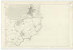
OS1/14/72/64
| List of names as written | Various modes of spelling | Authorities for spelling | Situation | Description remarks |
|---|---|---|---|---|
| SUSPENSION BRIDGE [Montrose] | Suspension Bridge Suspension Bridge Suspension Bridge Suspension Bridge |
G.C. Myres Esqr. Mr. Wood Adam Burness Esqr. Mr. Greig |
035 | A fine Suspension Bridge [across] the South Esk immediately at the end of Bridge St. on the Road leading to Arbroath. It was erected in 1829 at a cost of £20,000. |
| PUBLIC BATHS [Montrose] | Public Baths Public Baths Public Baths |
On Front of Building Mr. Wood G.C. Myres |
035 | A small public building fitted with baths, situated immediately at the E. [east] end of the Suspension Bridge. |
| Site of FORT HILL | 035 | These hillocks are shown on the "Plan of the South Links of Montrose by George Robertson 1813" and the Windmill, and Flag Staff and Dial represented. Horologe Hill with the Flagstaff and Dial are also shown on a "Plan of the Harbour of Montrose by George Buchanan C.E. [Civil Engineer] 1827". They were all carted away in the course of Building operations by James Fraser (Town Councillor & Treasurer) and are well remembered in the locality. I consider it of interest to perpetuate the sites of these hillocks, which were notable in the history of ancient Montrose and of its fishing people. Jervise in his "Memorials" remarks "apart from the Basin, the leading topographical features were of old three hills called Fort, the Horologe and Windmill Hills" They were well known to Mr Myres and to all the old residents. [Initialled] J.B. Lt.Col. [Lieutenant Colonel] |
||
| Site of HORLOGE HILL | 035 | These hillocks are shown on the "Plan of the South Links of Montrose by George Robertson 1813" and the Windmill, and Flag Staff and Dial represented. Horologe Hill with the Flagstaff and Dial are also shown on a "Plan of the Harbour of Montrose by George Buchanan C.E. [Civil Engineer] 1827". They were all carted away in the course of Building operations by James Fraser (Town Councillor & Treasurer) and are well remembered in the locality. I consider it of interest to perpetuate the sites of these hillocks, which were notable in the history of ancient Montrose and of its fishing people. Jervise in his "Memorials" remarks "apart from the Basin, the leading topographical features were of old three hills called Fort, the Horologe and Windmill Hills" They were well known to Mr Myres and to all the old residents. [Initialled] J.B. Lt.Col. [Lieutenant Colonel] | ||
| Site of WINDMILL HILL | 035 | These hillocks are shown on the "Plan of the South Links of Montrose by George Robertson 1813" and the Windmill, and Flag Staff and Dial represented. Horologe Hill with the Flagstaff and Dial are also shown on a "Plan of the Harbour of Montrose by George Buchanan C.E. [Civil Engineer] 1827". They were all carted away in the course of Building operations by James Fraser (Town Councillor & Treasurer) and are well remembered in the locality. I consider it of interest to perpetuate the sites of these hillocks, which were notable in the history of ancient Montrose and of its fishing people. Jervise in his "Memorials" remarks "apart from the Basin, the leading topographical features were of old three hills called Fort, the Horologe and Windmill Hills" They were well known to Mr Myres and to all the old residents. [Initialled] J.B. Lt.Col. [Lieutenant Colonel] |
Continued entries/extra info
[Page] 64Transcribers who have contributed to this page.
Alison James- Moderator, Caspell
Location information for this page.
Linked mapsheets.


