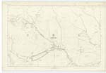
OS1/14/63/45
| List of names as written | Various modes of spelling | Authorities for spelling | Situation | Description remarks |
|---|---|---|---|---|
| SKEIR CRAIG | Skeir Craig Skeir Craig Skeir Craig Skear Craig |
Duncan Michie, Ground Officer Archibald Campbell, Inchgrundle James Mitchell, Glenmark County Map |
006 | A steep and somewhat rocky hillside falling to "Easter Burn". |
| WET BUSH | Wet Bush West Bush |
Duncan Michie, Ground Officer Archibald Campbell, Inchgrundle James Mitchell, Glenmark County Map |
006 | A well known name applied to a rocky hillside falling to "Water of Mark", Origin of name unknown. |
| BURN OF GLASCORRIE | Burn of Glascorrie | Duncan Michie, Ground Officer Archibald Campbell, Inchgrundle James Mitchell, Glenmark |
006 | A good stream rising out of "Glas Corrie" and falling into "Water of Mark" about a mile above the "Manse", See Glas Corrie for Der. [Derivation] |
| GLENMARK | Glenmark | "Jarvise's Land of the Lindsays" Rev. [Reverend] Walter Low Co. [County] Map |
006 | This was formerly a farm house but is now occupied by a keeper for protection of the Earl of Dalhousie's Deer Forest. |
| CRAIG BREOSTOCK | Craig Breostock Craig Breostock Craig Breostock Craig Braestock |
Duncan Michie Archibald Campbell James Mitchell County Map |
006 | A prominent, precipitous, hillside on the south side of Glen Mark, Creag. a rock, Bristeach, brittle or confused. |
Continued entries/extra info
[Page] 45Co. [County] Forfar -- Parish of Lochlee
Transcribers who have contributed to this page.
Alison James- Moderator, KBMW- Moderator
Location information for this page.
Linked mapsheets.


