OS1/14/17/28


| List of names as written | Various modes of spelling | Authorities for spelling | Situation | Description remarks |
|---|---|---|---|---|
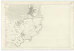
| Drainers or Dronner's Dyke (Continued | 035 | [continued from page 27] erected shortly before Capt. [Captain] Slezer visited Montrose. That Dyke was raised with a view to drain & make arable land of about 2000 Acres of the Basin which belonged in property to Erskine of Dun who disposed of it to certain parties who formed themselves into a co-partnery of whom the Earl of Kinghorn was one. That speculation turned out to be unsuccessful for the embankment had been scarcely accomplished when by a sudden storm, it was thrown down, & in consequence several of the projectors were rendered bankrupt. At Low Tides the Drainers Dyke is partially visible". Memorials of Angus & Mearns. The Traces of this Dyke are yet plainly visible in a mass of large loose stones, particularly where it forms an angle in crossing the burn or channel on this Trace. It gradually becomes faint leaving a slight shingly ridge towards the terminations of its ends on the East & West. Traces of the same ridge apparantly, but not forming a continuous or regular line, may be seen as shewn on Trace at intervals towards the land on the West side of the Basin. Drainers Dyke is not generally recognised except by intelligent persons, but "Dronners Dykes" is well known & used by all referred to who know this. |
Continued entries/extra info
[Page] 28Co. [County] Forfar -- Parish of Dun
Transcribers who have contributed to this page.
Alison James- Moderator, Alice Bremner
Location information for this page.
Linked mapsheets.