OS1/13/81/70


| List of names as written | Various modes of spelling | Authorities for spelling | Situation | Description remarks |
|---|---|---|---|---|
| CRAIG HEUGH | Craigheugh Craigheugh Craigheugh Craigheugh |
John Bennet Earlsferry Thomas Fenwick Elie Alexander Finlayson Grangehill Map of County by John Ainslie(no date) |
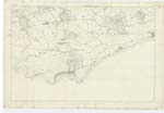
026 | This applies as a proper name to a long steep ridge of traprock along the side of Kincraig Hill & rising about 200ft. [Feet] above the line of high water forming a bold and nearly perpendicular precipice of rugged front and much broken by natural indentures |
| RUDDONS POINT | Ruddons Point Ruddons Point Ruddons Point |
John Bennet Earlsferry Thomas Fenwick Elie Map of County by John Ainslie (no date) |
026 | A long narrow stripe of flat ground on the farm of Kincraig and projecting for a considerable distance into the Firth of Forth. its surface consists of R.P. [Rough Pasture] with a few small rocks towards the line of High Water, near which on it is a Trig [Trigonometrical] Station called by Trig [Trigonometrical] Party Ruddons Point the origin of this name is not locally known |
Continued entries/extra info
70 List of names collected by Thomas Smith C.Asst [Civil Assistant][Parish of] Kilconquhar Plan 26C Trace 3
[page signed] Thomas Smith c/a [Civil Assistant]
12th May 1853
Transcribers who have contributed to this page.
MaxInSpain , MASab
Location information for this page.
Linked mapsheets.