OS1/13/134/40


| List of names as written | Various modes of spelling | Authorities for spelling | Situation | Description remarks |
|---|---|---|---|---|
| WHITESANDS BAY | Whitesands Bay Whitesands Bay Whitesands Bay Whitesands Bay Whitesands Bay |
Lithograph Map 1837 Mr. Flockhart Mr. J. Barr Mr. P. Kennedy Mr. Chisholm |
036 | A Sandy bay Sheltered by the land on three sides, it is not used as a Harbour but very easily be made available for that purpose. |
| HANGING CRAIG | Hanging Craig Hanging Craig Hanging Craig Hanging Craig |
Mr. Flockhart Mr. J. Barr Mr. P Kennedy Mr. Chisholm |
036 | A large overhanging Sandstone Rock in the Hughses. |
| HAWK CRAIG | Hawk Craig Hawk Craig Hawk Craig Hawk Craig Hawk Craig Hall Craig Hall Ccraig Point |
Mr. Flockhart Mr. P. Kennedy Mr. John Catton Mr. Chisholm Lithograph Map 1837 Mr. J. Barr Map of Dalachy Farm 1837 |
036 | A Steep rocky brow or precipice partly covered with Brushwood and trees. The Southern part of it is Whinstone and used for the repairs of Roads. It is well known by the name of Hawk Craig, from the fact of the birds called Hawks frequenting it. No one in the neighbourhood knows it by the name of Hall Craig except Mr Barr. |
Continued entries/extra info
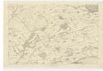
[Page] 40Plan 36C Aberdour Parish
⅝ Mile E. [East] of the village of Aberdour [Situation for Whitesands Bay]
¾ Mile E. [East] of the village of Aberdour [Situation for Hanging Craig]
⅝ Mile E. [East] of the village of Aberdour [Situation for Hawk Craig]
Transcribers who have contributed to this page.
GreenflyNZ, JCB
Location information for this page.
Linked mapsheets.