OS1/13/134/39


| List of names as written | Various modes of spelling | Authorities for spelling | Situation | Description remarks |
|---|---|---|---|---|
| THE HUGHSES | The Hughses The Hughses The Hughses The Hughses Hughses |
Mr. Flockhart Mr. J. Barr Mr. P. Kennedy Mr. Chisholm Lithograph Map 1837 |
036 | A long steep brow parallel to the coast planted with Forest trees mixed with a few Fir. The property of the Earl of Morton. |
| THE LONG HAUGH | The Long Haugh The Long Haugh The Long Haugh The Long Haugh |
Mr. Flockhart Mr. J. Barr Mr. P. Kennedy Mr. Chisholm |
036 | A flat piece of ground planted with mixed Fir and Forest trees the property of the Earl of Morton |
| HAWKCRAIG PLANTATION | Hawkcraig Plantation Hawkcraig Plantation Hawkcraig Plantation Hawkcraig Plantation |
Mr. Flockhart Mr. J. Barr Mr. P Kennedy Mr. Chisholm |
036 | A patch of wood principally Forest trees mixed with a few Fir, the property of the Earl of Morton. |
Continued entries/extra info
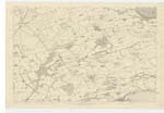
[Page] 39Plan 36C Aberdour Parish
Note: Haugh; Hauch. - Low lying ground Jamesons Scottish Dictionary (This applies well)
Haugh - Low lying ground Jameson
About ⅝ Mile E. [East] of the village of Aberdour [Situation for The Hughses]
½ Mile E. [East] of the village of Aberdour [Situation for The Long Haugh]
⅜ Mile E. [East] of the village of Aberdour [Situation for Hawkcraig Plantation]
Note: Heugh or Heuch - A precipice
Note: Hughses - This is a resort for bathers and is invariably spelled The Hughses in the locality.
Note: Hughses: Precipices along the Sea Coast of the Southern were all called Haughs and written so upon the ordnance Maps. "The precipitous rocks along the side of the sea between Arbroath & the Reahead are all called Heughs" Jameson
Transcribers who have contributed to this page.
GreenflyNZ, JCB
Location information for this page.
Linked mapsheets.