OS1/15/27/30


| List of names as written | Various modes of spelling | Authorities for spelling | Situation | Description remarks |
|---|---|---|---|---|
| CRAIGIELAW POINT | Craigielaw Point Craigielaw Point Craigielaw Point West Point |
Thomas Christison James Armstrong Mr Lamb Co. [County] Map 1799 |
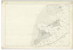
004 | [Situation] About 3/4 Mile W. by S. [West by South] from Luffness House A headland on the Sea coast of the farm of Craigielaw. Its Surface consists of rough pasture land. |
| LONG CRAIG | Long Craig Long Craig |
Revd. [Reverend] J. Smith John Tait |
004 | [Situation] About 3 Chains North from Craigielaw Point A rugged ledge of rocks situated between high and low water mark and on the margin of the Peffer Burn. |
Continued entries/extra info
[Page] 30Parish of Aberlady
66 Craigielaw Point
76 Long Point
Transcribers who have contributed to this page.
Nellie- Moderator, Ian Anderson
Location information for this page.
Linked mapsheets.