OS1/15/3/29


| List of names as written | Various modes of spelling | Authorities for spelling | Situation | Description remarks |
|---|---|---|---|---|
| PENSHIEL HILL | Penshiel Hill Penshiel Hill Penshiel Hill Painshiel Hill |
Mr. Darling James Renwick Johnston's Co. [County] Map Forrest's Co. [County] map. |
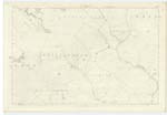
016 | [Situation] About a Mile S.E. by E. [South East by-East from Mayshiel. A heathy hill on the farm of Penshiel and forming part of the "Lammermoor" range, there is a Trig. [Trigonometrical] Station on its summit, |
| KINGSIDE HILL | Kingside Hill Kingside Hill King Side Hill King Side Hill |
Mr. Darling James Renwick Johnston's map Forrest's Co. [County] map. |
016 | [Situation ] About 3/4 of Mile N.E. [North East] from Mayshiell A heathy hill on the farm of "Kingside", on its summit is a Trig. [Trigonometrical] Station; At the w. [west] end of this hill are two small cairns or Tumulus and a small circle of stones said to bee "Druidical" remains, on the Co. [County] Map the word camp is enserted, but the remains of such cannot now be discerned; |
Continued entries/extra info
[Page] 29Parish of Whittinghame
Form 136 page
49 Penshiel Hill
48 Kingside Hill
Transcribers who have contributed to this page.
Trondragirl- Moderator, Douglas Montgomery
Location information for this page.
Linked mapsheets.