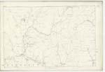
OS1/10/55/6
| List of names as written | Various modes of spelling | Authorities for spelling | Situation | Description remarks |
|---|---|---|---|---|
| EWE HILL | Ewe Hill Ewe Hill |
John Dalgleish William ParK |
044 | [Situation] About 50 Chains S.E [South East] of BoyKenhopehead A considerable hill on the farms of "Hopsrig" and "Laggan Head" covered with rough Pasture. An undefined Bdy. [Boundary] Seperating the Parishes of Westerkirk & Tundergarth passes over this hill, and on its Summit is a Trigl. [Trigonometrical] Stn. [Station]. |
| DICK'S DRAIN | Dick's Drain Dick's Drain |
John Dalgleish William ParK |
044 | [Situation] Joins BoyKin Burn 3 Chains South of BoyKinhopehead. A small but rough & rapid stream which rising in the West Side of "Ewe Hill" runs in N. [Northerly] direction till it joins "Trough Burn". |
Continued entries/extra info
[Page] 6WesterKirK Parish Sheet 44 No.3 Trace 2
Hen Hill - See Name Sheet for Plan 44/7 Page 13.
The Shin - See Name Sheet for Plan 35/16 Book No. 4
Transcribers who have contributed to this page.
DANIALSAN, Brenda Pollock
Location information for this page.


