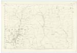
OS1/10/50/145


| List of names as written | Various modes of spelling | Authorities for spelling | Situation | Description remarks |
|---|---|---|---|---|
| CRIFFEL | Criffel | Estate Map John Carruthers Kirkhill John Charters Parish Schoolmaster |
025 | A high conical shaped hill on the farm of Kirkhill, and a short distance South from Howgill Fell |
| SEMBLETREE BURN | Sembletree Burn Sembletree Burn |
Estate map John Carruthers Kirkhill John Charters Parish Schoolmaster C Stewart Esq [Esquire] |
025 | Rises on the March betwixt the farms of Kirkhill, and Fingland, at a point a short distance South from Criffel, and runs Eastward to the Back Burn, in the Parish of Hutton and Corrie |
| SEMBLETREE KNOWE | Sembletree Knowe Sembletree Knowe |
Estate Map John Carruthers Kirkhill John Charters Parish Schoolmaster C Stewart Esq [Esquire] |
025; 034 | A round hill of medium height on the right of Sembletree Burn, and in the easterm boundary of the Parish, This hill has a very black appearance when seen from the north, owing to the abundance of heather that grows on it. |
Continued entries/extra info
145 Parish of Wamphray Sheet 25.14 Trace 5Criffel situation South Eastern Parish district
Sembletree Burn situation From between That and Semble tree Knowes, North East to the Eastern Parish Boundary
Sembletree Knowe situation About 1/2 mile South East from Criffel, on the Boundary between Hutton and Corrie and Tundergarth.
John Jane Sapper Royal Engineers
Transcribers who have contributed to this page.
stellas
Location information for this page.