OS1/10/50/144


| List of names as written | Various modes of spelling | Authorities for spelling | Situation | Description remarks |
|---|---|---|---|---|
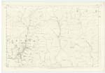
| DEADMAN'S GILL | Deadman's Gill | Estate map John Carruthers Kirkhill John Charters Parish Schoolmaster |
025 | A narrow glen the sides of which are steep, and covered with projecting rocks. A small stream that trickles through it, rises at the head of Tath Knowes, and runs into the Steffenbiggin Burn. |
| TATH KNOWES | Tath Knowes | Estate Map John Carruthers Kirkhill John Charters Parish Schoolmaster |
025 | This name is given to a number of rounded eminences, the highest of which may be called a hill, Situated on the farm of Kirkhill, and near the march betwixt that farm and Fingland. |
Continued entries/extra info
144 Parish of Wamphray Sheet 25.14 Trace 4Tath Knowes situation 34 Chains South West from Criffel
That Knowes Syke See Page 137
Tathknowes Plantation scored out
Deadmans Gill situation 32 Chains West from Criffel
John Jane Sapper Royal Engineers
Transcribers who have contributed to this page.
stellas
Location information for this page.
Linked mapsheets.