OS1/10/45/21


| List of names as written | Various modes of spelling | Authorities for spelling | Situation | Description remarks |
|---|---|---|---|---|
| MOLLS CASTLE (Site of) | Moll's Castle (British Fort) Moll's Castle Molls Castle Norwood Camp The Camp Maul's Castle Mall's Castle British Camp |
Mr. George Jamieson, farmer Mr. Hugh Miller of Norwood farm Mr. William Jamieson farmer Mr. Joseph Catton Mr. John Douglas Johnston's County Map Genl. [General] Roy's Map of Roman Antiquities in Lower Annandale New Stat Acct [Statistical Account] of St. Mungo. |
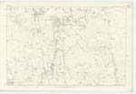
051 | [Situation] Nearly 1 mile S.S.W [south South West] of Murrayfield The vestiges of An Ancient entrenchment on the farm of Norwood, which has been a Camp of the round form. The existing features of its Circumference &c. are distinctly traceable by a slight elevation, which formed the base of the outward Rampart. The N.W. [North West] Side bounded by a quicKwood hedge represent the remains of banK Very Clearly, where it remains unremoved, There are no vestiges of a fosse, or ditch, the whole is Arable, And consists of a shallow Concavity, within. It is recognised as being a Roman Camp. Being near Brunswark hill (one of the principal Roman Camps in the County) it may have been used by the Romans as a watch, or exploratory post for Such posts were usual in that time but it is doubtful that they Constructed the round Camp. It is either Danish or British which is yet a mystery. Moll's Castle is the old original name, and the correct name. |
Continued entries/extra info
[Page] 21Parish of Saint Mungo -- Plan 51.6 Trace 4
[Signed] M. Donohue
Jany. [January] 1857
Transcriber's notes
Molls Thorn scored throughTranscribers who have contributed to this page.
Chr1smac -Moderator, DANIALSAN
Location information for this page.
Linked mapsheets.