OS1/10/44/101


| List of names as written | Various modes of spelling | Authorities for spelling | Situation | Description remarks |
|---|---|---|---|---|
| KELLO WATER | Kello Water , | John Dryfe James Pearson Johnston's County Map. |
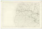
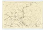
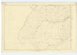
005; 006; 012 | A considerable stream having its source on Black Larg Hill on the boundary between the Counties of Ayr and Dumfries', and falling into the Nith a short distance to the east of Old Kello Side, It flows through a very bleak - moorland dis- -trict and its bed generally but more particularly from the sheep bridge at Drumbuie Plantation to Old Kello Side is of an exceedingly rugged Character being covered in many places with large blocks of Rock apparently of the transition Class. The Kello from the Nith to the County Boundary (Ayr & Dumfries') forms the boundary between the parishes of Sanquhar and Kirkconnel, |
Continued entries/extra info
[Page:] 101,Parish of Sanquhar, -- Sheet 5. 12. Trace No. [Number] 1.
[KELLO WATER - Situation:]
On Wn. [Western] Parish
Boundary. -
[Page is signed:]
Thomas Matheson C. A [Civilian Assistant]
Transcribers who have contributed to this page.
George Howat
Location information for this page.