OS1/10/44/100


| List of names as written | Various modes of spelling | Authorities for spelling | Situation | Description remarks |
|---|---|---|---|---|
| STAKE MOSS | Stake Mofs [Moss] | James Mitchell Estate Map William Colthart |
007 | Situation:]Adjoining Wanlockhead on the S. E. [South East] extending E. [East] to En. [Eastern] Parish Boundary. A district of Moor to the East & [South] East of Wanlockhead, very rough & [Heaths] |
| MOSSY BURN | Mossy Burn | James Mitchell Estate map dated 1831 Estate Map date 1805 deposited at Wanlockhead |
007 | [Situation] From near the En. [Eastern] Parish Boundary S.S.W. [South South West] to Menock Water . - A small Burn rising in a little Glen [Stake] Moss , and running in a westerly direction [and] joins the Mennock Water about 1 m [mile] [from WanlockHead |
| LITTLE ARTHUR GRAIN | Little Arthur Grain | James Mitchell Old Estate Map Mr. James Stewart. |
007 | [Situation] Towards the South of Stake Moss S.W. [South West] to Mossy Burn, - A small Burn rising at the Head of [Stake Moss] and running in a Westerly direction. [?] Mossy Burn |
Continued entries/extra info
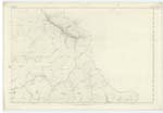
[Page] 100,Parish of Sanquhar -- Plan 7.7. Trace 2.
[Signed]
Charles J Fearnside
Pte. [Private] R. S. & Ms. [Royal Sappers and Miners]
Transcribers who have contributed to this page.
KimHarsley-ProjectOfficer, Chr1smac -Moderator, George Howat
Location information for this page.
Linked mapsheets.