OS1/10/42/36


| List of names as written | Various modes of spelling | Authorities for spelling | Situation | Description remarks |
|---|---|---|---|---|
| BITCH BURN | Bitch Burn Bitch Burn Bitch Burn |
Robert Dryfe Samuel Sharpe William Sharpe |
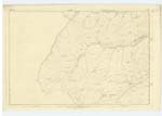
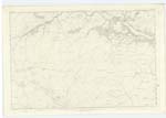
012 | A small stream that takes its rise near the North of this Parish a[nd] flows in a South East direction and joins the Scar Water |
| WEE BURN | Wee Burn Wee Burn Wee Burn |
Robert Dryfe John Milligan Samuel Sharpe |
012 | A small stream that r[ises] on Pulgowan flows in a North West direction and joins the Scar Water |
| LANGSIDE END | Langside End Langside End Langside End |
Robert Dryfe John Milligan Samuel Sharpe |
012; 013 | A name given to the point of a long ridge |
Continued entries/extra info
36Parish of penpont
Plan 12/16
Trace 3
[Bitch Burn, in the 'Situation' column, reads] From Bitchburn Head at NWn. [North Western] extremity of Parish s.S.E. [South South East] to Scar Water
[Wee Burn, in the 'Situation' column, reads] On the heights in NWn. [North Western] Parish district.-
[Langside End, in the 'Situation' column, reads] Inwards NWn. [North Western] district of parish
[signed] James Cowan CA
Transcriber's notes
A small part of the right hand side of this page is missing, completion of some words estimated.For Wee Burn, in the 'General Observations' it is recorded as rising on Pulgowan Hill and [], but the 'Hill and' is crossed out.
For Langside End, the Alternative Name was also marked as Landside End, the 'd' in Land having been added over an original 'g', but was all crossed out, and a clear 'Langside' left. Also, in 'General Observations' originally read 'A name given to a considerable track of Pulgowan Hill', but was largely crossed out and the final text added
Transcribers who have contributed to this page.
John Dunlop
Location information for this page.