OS1/10/40/1


| List of names as written | Various modes of spelling | Authorities for spelling | Situation | Description remarks |
|---|---|---|---|---|
| MORTON [parish] | Morton Morton Morton |
Walker's Co[unty] Map Crawford's Co[unty] Map Johnstone's Co[unty] Map |
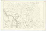
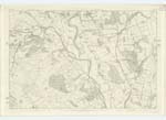
014; 015; 022; 023; 031 | [Situation] In Upper Nithsdale between Closeburn, Penpont and Durisdeer in Dumfriesshire and Crawford in Lanarkshire This name is Anglo-Saxon and is generally supposed to signify "the Stronghold or dwelling on the Moor" Near the centre of Parish at the N.W. extremity of an extensive Moor there still exist the Remains of a stronghold "Morton Castle" The Parish of Morton is bounded on the W. and N.E by Crawford in Lanarkshire, on the East and South by Closeburn, on the South-West and West by Penpont and Durisdeer. Its shape is an irregular, oblong with two points respectively projecting beyond the rest at the N.E. and S.W. The boundaries of this projection at the North-East are undefined. On the E. and S of the Parish the Boundaries are for the most part defined and traced by Cample Water, on the S.W. at the point of projection above mentioned the Boundaires are defined by a hedge and paling, on the W. and N. to Morton within the boundaries of another Parish nor within its limits as above described a detached part of any other Parish. The extent is about 7 miles from North to South and mean breadth 2½ miles. The area as [?] Statistics is 9,000 Imp[eria]l acres or [?] Fullarton 12¾ miles or 6,496 Scotch Acres which would give as 23=29 8,181; say 8,157 Imp[eria]l Acres, 3,000 of which may be cultivated, 700 wood, 957 capable of cultivation an 3,500 rough pasture and irreclaimable, - the whole with the exception of the farm of Riddings belongs to the Duke of Buccleuch. The surface is diversified by ridge and valley, the highest ground which lies towards the North attains a height of 2,500 feet above sea level. The hills or ridges run across the Parish from N.W. to S.E. The level ground is chiefly along the banks of River Nith and Cample Water and which is well protected by embankments from the encroachments of these Streams. The soil is dry and very productive. Farming and the rearing of Cattle are extensively carried on under the direct superindence of the Buccleuch's Steward, consequently large tracts of waste land are annually reclaimed. The Parish is well watered on each side by the Cample, Nith and Carron, numerous burns and rills and perennial springs supply the interior thereof. Among the latter a Spa or Strong Chalybeate Spring called Physic Well. Several small pieces of water are in the vicinity of Thornhill. The Turnpike from Dumfries and from Kirkcudbright [?] Moniaive and Penpont respectively enter the Parish at the South & West sides become convergent at Thornhill, run North-west for about 1½ miles to Carronbridge where they diverge towards Glasgow and Edinburgh. The North-East or upper district is almost destitute of Roads. The Glasgow and SWn [Southwestern] Railway enters the Parish near the middle of W[ester]n Boundary and runs S.E. towards Carlisle. No manufacture is |
| MORTON [parish] | Morton Morton Morton |
Walker's Co[unty] Map Crawford's Co[unty] Map Johnstone's Co[unty] Map |
014; 015; 022; 023; 031 In Upper Nithsdale between Closeburn, Penpont and Durisdeer in Dumfriesshire and Crawford in Lanarkshire |
This name is Anglo-Saxon and is generally supposed to signify "the Stronghold or dwelling on the Moor" Near the centre of Parish at the N.W. extremity of an extensive Moor there still exist the Remains of a stronghold "Morton Castle" The Parish of Morton is bounded on the W. and N.E by Crawford in Lanarkshire, on the East and South by Closeburn, on the South-West and West by Penpont and Durisdeer. Its shape is an irregular, oblong with two points respectively projecting beyond the rest at the N.E. and S.W. The boundaries of this projection at the North-East are undefined. On the E. and S of the Parish the Boundaries are for the most part defined and traced by Cample Water, on the S.W. at the point of projection above mentioned the Boundaires are defined by a hedge and paling, on the W. and N. to Morton within the boundaries of another Parish nor within its limits as above described a detached part of any other Parish. The extent is about 7 miles from North to South and mean breadth 2½ miles. The area as [?] Statistics is 9,000 Imp[erial] acres or [?] Fullarton 12¾ miles or 6,496 Scotch Acres which would give as 23=29 8,181; say 8,157 Imp[erial] Acres, 3,000 of which may be cultivated, 700 wood, 957 capable of cultivation an 3,500 rough pasture and irreclaimable, - the whole with the exception of the farm of Riddings belongs to the Duke of Buccleuch. The surface is diversified by ridge and valley, the highest ground which lies towards the North attains a height of 2,500 feet above sea level. The hills or ridges run across the Parish from N.W. to S.E. The level ground is chiefly along the banks of River Nith and Cample Water and which is well protected by embankments from the encroachments of these Streams. The soil is dry and very productive. Farming and the rearing of Cattle are extensively carried on under the direct superindence of the Buccleuch's Steward, consequently large tracts of waste land are annually reclaimed. The Parish is well watered on each side by the Cample, Nith and Carron, numerous burns and rills and perennial springs supply the interior thereof. Among the latter a Spa or Strong Chalybeate Spring called Physic Well. Several small pieces of water are in the vicinity of Thornhill. The Turnpike from Dumfries and from Kirkcudbright [?] Moniaive and Penpont respectively enter the Parish at the South & West sides become convergent at Thornhill, run North-west for about 1½ miles to Carronbridge where they diverge towards Glasgow and Edinburgh. The North-East or upper district is almost destitute of Roads. The Glasgow and SWn [Southwestern] Railway enters the Parish near the middle of W[ester]n Boundary and runs S.E. towards Carlisle. No manufacture is |
Continued entries/extra info
Parish of Morton Parish County DumfriesTranscribers who have contributed to this page.
lowlandscot
Location information for this page.
Linked mapsheets.