OS1/10/27/2


| List of names as written | Various modes of spelling | Authorities for spelling | Situation | Description remarks |
|---|---|---|---|---|
| HUTTON AND CORRIE | Hutton and Corrie | Crawford's Map of Dumfries-shire Blackwood's Map of Dumfries-shire Johnston's Map of Dumfries-shire |
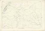
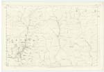
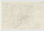
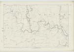
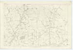
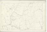
017; 025; 034; 035; 036; 043; 044 | [Continued from page 1] acres, but has now been computed at nearly 24,000 Impl. [Imperial] Acres, of which about 4,000 acres may be arable, 15,000 Sheep-pasture, and about 5,000 grazing land. The arable land is situate chiefly in the Sn. [Southern] district, occasional strips of good land occurring on the faces of the several ranges of hills. This Parish however may be classified as pastoral, the most extensive farms being occupied in breeding Cheviot Sheep and the rearing of black cattle. Two ranges of hills measuring from 500 to 1200 feet stretch from near the middle of Parish North respectively along the Wn. [Western] and En. [Eastern] boundary both terminating in a point at Loch Fell a height of upwards of 2000 feet. The vale between these ranges is traversed by Dryfe Water the principal stream of the district. Corrie Water also a considerable Stream runs in a S.Wn. [South Western] direction across the Sn. [Southern] district - numerous rills contributing their quota thereto. A line of Turnpike Road from Langholm to Moffat, traverses in a N.Wn [North Western] direction the S.Wn. [South Western] district. No manufactory is carried on nor minerals wrought. There is nothing in it deserving of the name of village or town. There are a Parish Church and two parochial Schools. The principal proprietor is J.J. Hope Johnstone of Raehills, M.P. [Member of Parliament]. Population about 900. There are several remains of old enclosures, says the Old Statistical Account, of a circular form called British Forts, and a square one at Cartertown of the Roman kind; but there is no record nor tradition of those who founded or used them" and which as they occur throughout the Parish have been characterized on Plans accordingly. Remains still exist of Mosskesso and Gillesbie Tower, two strongholds which belonged to the family of Graham respecting which the Old Statistical Account of Dumfries has the following "The Grahams of Gillesbie had their residence at a place called Maskersa, of which there is some remains and appearance of strength on the farm of Closs. But they removed from it nearly 300 years ago to a tower on the brink of Dryfe, which, by the thickness of the walls and the fosse appears to have been strong, but having been treated like many others of the same kind and converted into a quarry for other buildings, there are only a few yards of the walls remaining". Remains still exist also of Lunelly Tower a stronghold which belonged to the family of Corrie of that ilk and was subsequently acquired by the Johnstone family through marriage with a daughter of Sir Thomas Corrie about 300 years ago. An artificial mound called Hutton Moat situate in the S.Wn. [South Western] district, and still perfect, is said to have been formerly used as a beacon post. Corrie Parish having been annexed to that of Hutton in 1609. the Church was disused, the site of which however has been shewn from indications in the graveyard attached thereto which is still in use. |
Continued entries/extra info
[Page] 2Parish of Hutton and Corrie -- County of Dumfries.
Transcribers who have contributed to this page.
CorrieBuidhe- Moderator, mikeh
Location information for this page.
Linked mapsheets.