OS1/10/21/24


| List of names as written | Various modes of spelling | Authorities for spelling | Situation | Description remarks |
|---|---|---|---|---|
| THE CANT | The Cant The Cant The Cant |
William Wilson William Todd John Ferguson |
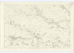
020 | A considerable hill on the lands of Blairoch the name has been established from time immemorial. |
| BAIL HILL | Bail Hill Bail Hill Bail Hill |
William McCaw William Proudfoot Adam Glover |
020; 021; 022; 029 | A range of hill of Considerable eminence at the N.W. corner of Cormilligan farm in Tynron. |
| BLAIROCH | Blairoch Blairoch Blairoch |
William Wilson William Todd Modern Valuation Roll |
020 | A Farmhouse and outbuildings with garden and lands attached, the property of Samuel McCall Esq. |
| DALWHAT WATER | Dalwhat Water Dalwhat Water Dalwhat Water |
William Wilson James Broom Esq. William Broom Esq. |
020; 029; 030 | A small River formed by the Confluence of Glenjaan, Dibbon, and Fernhead Burns and afterwards in its mean derings along the valley, everywhere flows between wooded banks. |
Continued entries/extra info
Parish of Glencairn, Page 24, Plan 20.16 Trace 3.[Signed] Philip Munro Pte. [Private] R.S.& M. [Private Royal Sappers and Miners].
BAIL HILL: On the Boundary between this Parish and Tynron.
BLAIROCH: Nearly 6 miles North West from Minnyhive.
DALWHAT WATER: From Northern point of Parish running S.E. to a point 1/2 mile S.E. from Minnyhive.
THE CANT: About 5 3/4 miles N.W. from Minnyhive.
Transcriber's notes
The entry for BLAIROCH was input onto the List of names as written as BLAROCH, I made the correction {DFF}.Dittos accounted for. DFF 18/05/14
Transcribers who have contributed to this page.
Kate51- Moderator, Derek Ferguson
Location information for this page.
Linked mapsheets.