OS1/10/21/23


| List of names as written | Various modes of spelling | Authorities for spelling | Situation | Description remarks |
|---|---|---|---|---|
| GREEN HILL | Green Hill Green Hill Green Hill |
William McCaw William Proudfoot Adam Glover |
020 | A high hill on the N. E'n [North Eastern] Parish Boundary said to reach 1800 ft. [feet] Above sea level. The highest point of Bail Hill. |
| BENBUIE | Benbuie Benbuie Benbuie |
William Wilson William Todd Modern Valuation Roll |
020 | A Farmhouse and outbuildings with garden and lands attached, the property of Miss M. Barber. |
| BENBUIE BURN | Benbuie Burn Benbuie Burn Benbuie Burn |
William Wilson William Todd John Ferguson |
020 | A small Rivulet which rises near the North side of the lands of Benuie and falls into Dalwhat Water near the farmhouse. |
Continued entries/extra info
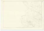
Parish of Glencairn, Page 23, Plan 20.16 Trace 3. [signed] Philip Munro Pte. [Private] R.S.M. [Royal Sappers and Miners].BENBUIE; 5 3/4 miles from Minnyhive.
BENBUIE BURN: From near the N. E'n. [North Eastern] Parish Boundary West by South.
GREEN HILL: on N. E'n [North Eastern] Parish Boundary.
Transcriber's notes
Entry for BENBUIE BRIDGE has been scored through by the Surveyor.Dittos accounted for. DFF 18/05/14
Transcribers who have contributed to this page.
Derek Ferguson
Location information for this page.
Linked mapsheets.