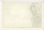
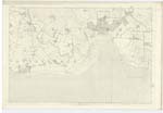
OS1/10/5/78
| List of names as written | Various modes of spelling | Authorities for spelling | Situation | Description remarks |
|---|---|---|---|---|
| SOLWAY FIRTH | Solway Frith Solway Frith Solway Frith Solway Frith Solway Firth |
Map of England Black's Co. [County] Map Scottish Nomenclature, Mr. James Hunter, Specimen sheet sent out from the Ordnance office to the Examiners in the Field. |
060; 061; 065; 066 |
[Situation] Washing the Parish on the South. A navigable Arm from the Irish Sea, North-Eastward, forming the boundary between England & Scotland for upwards of fifty miles Spring tides rise 20 feet, ordinary tise 10 or 12 feet. The navigation is greatly impeded of late years by the number of Sand banks which have greatly increased on the Scottish side |
Continued entries/extra info
[Page] 78Parish of Carlaverock
Plan 61.9 Trace 4
It appears that the word Frith in the name is doubtful as regards the orthograph. In the French language the word is written Frith that is Bras de mer, i.e an arm of the Sea. Detroit in the same, implies a Straight, or Frith Also in the Latin the word aestuarium, and fretum both of which means in that language a Frith or arm of the Sea, also all the English lexicographers write it Frith, consequently the correct mode may be Solway Frith.
N Donahue
Transcribers who have contributed to this page.
ADobie
Location information for this page.


