OS1/3/21/84


| List of names as written | Various modes of spelling | Authorities for spelling | Situation | Description remarks |
|---|---|---|---|---|
| BENBEOCH | Benbeoch Benbeoch Benbeoch Benbeoch Benbeoch Benbeoch |
Fullartons Gazetteer of Scotland 1854 Estate Map 1844 A. Hervey W. Gilchrist W. G. Galloway Johnston's County Map |
047 | This is the most prominent feature in the Parish excepting, the range of hill over which passes the Boundary between the Counties of Ayr & Kirkcudbright and Consequently the Boundary of this Parish - It rises abruptly and at a distance appears Conical, three of its Sides are Steep but its west Side has a gradual asent, the north is rocky and precipitous, Some places nearly inaccessible the east Side with the exception of Benbeoch Craig - is not So Steep but the Surface is covered with [large] loose Rocks, These rocks have evidently formed [the] Conspicuous features of this Hill on Some Occasion & from their present appearance there is no [doubt] but they have been thrown from what now is [called] 'Benbeoch Craig' by an eruption - in fact [--] the idea under which the neighbourhood labours [--] Still nothing traditionally is know [known] [--] it. The South Side is Steep and a little [--] The Rocks generally - are basaltic, of a prismatic form, numerous, and many [places] jutting from an overhanging the Slope of the Hill the property of the Hone. [Honourable] F. M. Cathcart |
Continued entries/extra info
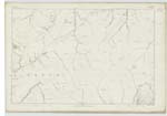
[Page] 84Dalmellington Parish-- Sheet 46 Plan 8 & Sheet 47 Plan 5
Transcribers who have contributed to this page.
Chr1smac -Moderator, hillhere
Location information for this page.
Linked mapsheets.